October 2023
Science
Rockfish in the rocks
A collaborative survey is helping fill in the gaps on distribution and abundance
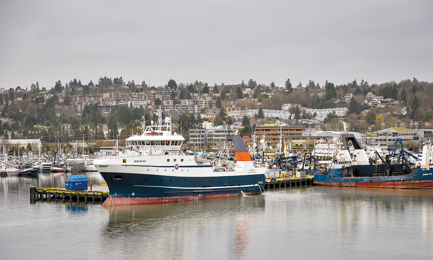
The trawler Araho, seen here in 2017 at Fishermen’s Terminal in Seattle, was one of three fishing vessels taking part in the cooperative survey in the Gulf of Alaska. Jeff Pond photo
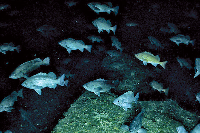
Dusky and northern rockfish in the Gulf of Alaska. NOAA Fisheries photo
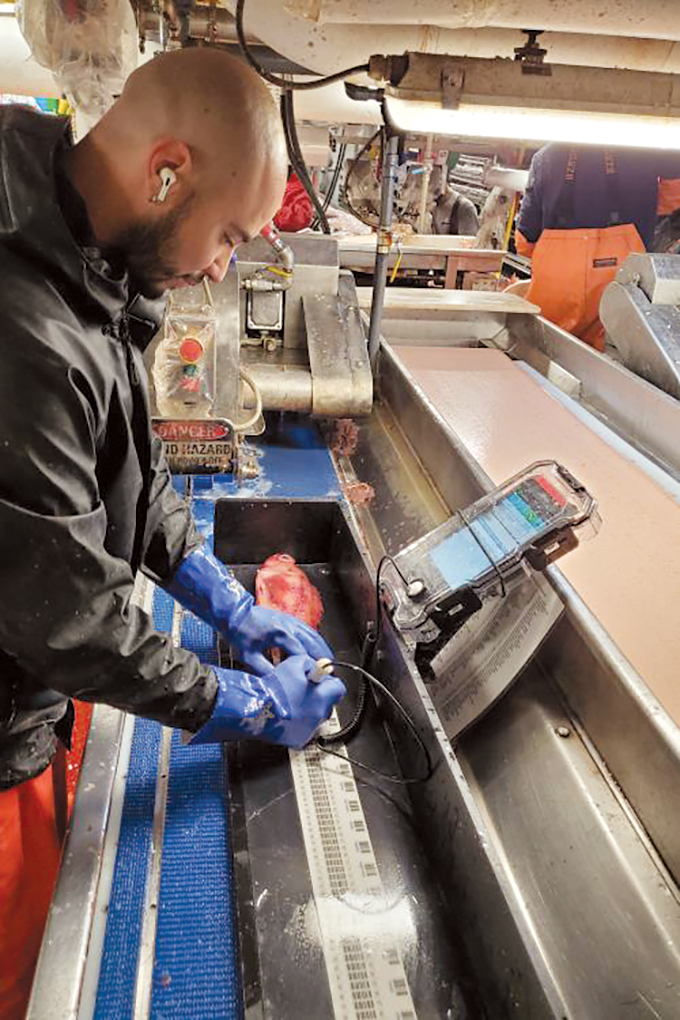
David Rodriguez measures rockfish caught during the collaborative survey in Alaska. Rory Morgan photo
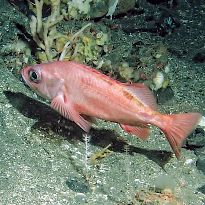
Pacific Ocean perch. NOAA Fisheries photo
NOAA Fisheries scientists, academic scientists at Alaska Pacific University’s FAST lab, and rockfish fishermen are working together to provide survey data in formerly inaccessible rocky areas.
Called the Science/Industry Rockfish Research Collaboration in Alaska (SIRRCA), the team collected a variety of data on several species of rockfish. There is little data available for some of these species.
In the Gulf of Alaska, there are more than 30 species of rockfish. The focus of this study is on Pacific Ocean perch, dusky rockfish, and northern rockfish.
By working with fishermen, the science team was also able to collect needed biological information on fish condition (i.e., length, weight) for stock assessments.
Limited data, limited fishing: For dusky and northern rockfish, data from the bottom trawl survey is limited. This leads to greater uncertainty in the assessment models. When models are less precise, management measures require a much more conservative approach to prevent overfishing the fish stocks. If these stocks are healthy, this precautionary management may limit sustainable fishing opportunities.
“Sampling these rocky areas is necessary to improve our understanding of rockfish distribution and abundance and provide more accurate stock assessments so resource managers can set sustainable fishing quotas,” said Madison Hall, fisheries biologist, Alaska Fisheries Science Center, who is leading the effort. “Our fishing industry partners involved in SIRRCA are fully invested in this effort to advance sustainable management for these long-lived, late-maturing rockfish species. They recognize that collecting SIRRCA data and improving assessment models may ultimately increase or decrease fishing opportunities (via higher or lower fishing quotas) depending on model outcome. Better models means better management, and good management is important for sustaining both the fishery and the fish populations in the long run. We are all on the same page about that.”
Survey highlights: This year, the survey was conducted in June and July. The team completed 73 tows, spanning a large area in the Western and Central Gulf of Alaska. The research team worked with three partner vessels to conduct the cooperative survey: Amendment 80 vessels Seafisher, America’s Finest, and Araho.
“The partnership with the industry has been invaluable. Our industry partners have experience fishing in these areas. They possess the skills to safely navigate the rough terrain. This is important for unbiased data collection,” Hall said.
Commercial fishermen and their fishing cooperatives have been participating in this research for several years now. They understand this project is key to the long-term health of the rockfish populations on which they depend.
“Even if the fish we catch from the survey hauls doesn’t cover our costs for fuel and crew, conducting the survey under the scientific protocols is the right thing for industry to be doing,” said Stan Morgan, F/V Araho captain.
Another project partner who has been involved since the project genesis is Capt. Bob Hezel. Hezel is a seasoned fisherman, fishing in Alaska since the 1970s.
“The project has a lot of potential to help us unite what fishermen see on the water every day with what scientists see during their annual survey snapshots. It will fill in important gaps in the data for areas that the surveys are missing,” Hezel said. “The new information will help improve rockfish estimates and support more sustainable fisheries.”
Next, Hall and the team worked to adapt NOAA Fisheries bottom trawl survey methods to work on partnering industry vessels.
“We have to be consistent in the way we collect data. This helps ensure we can compare across areas and years. It also helps us detect trends in abundance – whether populations are going up or down,” Hall said.
Through data analysis and conversations with fishermen, scientists determined how best to assess abundance in these areas. When combined with data collected from other areas, scientists are able to get a better picture of the entire population for each of these species.
Data are being collected using different commercial fishing vessels than are contracted to conduct the annual NOAA Fisheries bottom trawl survey. So, scientists need to conduct “calibration tows.”
This year, the fishing vessels in the pilot program conducted 30 calibration tows in the same areas sampled during the annual NOAA Fisheries bottom trawl survey. They also conducted 43 experimental tows in rocky areas – areas where the standard NOAA Fisheries survey vessels can’t go. Scientists are using statistical methods to correct for any differences in catch rates between the different vessels.
“It’s important that we understand and correct for the differences in catch rates so that the data can be used to accurately estimate fish abundance in the area,” Hall said. “To do this right takes time. Vessel calibration experiments must be carefully planned and executed to produce useful and precise correction factors. This is essential to make sense of the experimental catches we see on our partnering industry vessels sampling in rocky areas.”
Scientists were able to collect important biological information from these tows. They collected:
• 51 biological samples from harlequin rockfish to be used in genetic studies
• Catch, length, and weights for Pacific Ocean perch, northern rockfish, and dusky rockfish
• Location information (latitude and longitude) for each of the hauls
• Acoustic information to complement biological data for estimating fish abundance.
What’s next for the rockfish project? The team plans to hold a workshop in the fall to review how the survey went and develop a plan for the future of the project. There also is a substantial amount of data to analyze from this year’s hauls in both calibration and experimental tows. With three years of data, the next phase of the project will be working to integrate the data into the stock assessments.
“We need to collect enough data to make real improvements to the population estimates, but also we need to make sure our industry partners are not overburdened by the sampling methods. We know that going to these additional areas uses extra fuel and takes time away from commercial fishing and that the survey catches are too small to fully compensate for this. We have to find a level of sampling that works both for the survey and our industry partners,” Hall said.
Beyond that, the team hopes to expand the cooperative rockfish survey efforts to include other rockfish species/groups (e.g., harlequin) and regions (i.e., the Aleutians).
Special thanks to:
• Groundfish Forum
• Alaska Groundfish Data Bank
• AIS Observers Inc. (Luke Syzmanski, Rory Morgan, David Rodriguez)
• Brad Harris, Alaska Pacific University
• Fishermen’s Finest (captains Hezel and Erin Moore, Annika Saltman, and the crew of America’s Finest)
• Ocean Peace Inc. (Capt. Pat Haley, Todd Loomis, and the crew of the Seafisher)
• O’Hara Corp. (Capt. Stan Morgan, Jason Anderson, Frank Fogg, Mary Beth Tooley, and the crew of the Araho).
– NOAA Fisheries

Look inside the latest issue:
Salmon season wrapup:
A look at how Pacific salmon fisheries unfolded in 2023
Featured Story: The new Arctic Fjord
Home | About | Contact | Classifieds | Advertise | Subscribe | Fish Wrap Archives
![]()
![]() | 206.324.5644 | 941 Powell Ave. SW, Ste. 120, Renton, WA 98057 | © 2023 Pacific Fishing
| 206.324.5644 | 941 Powell Ave. SW, Ste. 120, Renton, WA 98057 | © 2023 Pacific Fishing